
PORTE DA AREIA SUL
Areia Sul Port
UM PORTINHO NA CIDADE
A praia do Portinho da Areia Sul é uma praia oceânica situada, como o nome indica, na costa sul da península de Peniche. As imponentes formações rochosas dominam a paisagem, dentro e fora de água. A pedra utilizada na construção das fortificações de Peniche foi daqui extraída.
Nesta zona existiu uma pequena estrutura militar construída pelas tropas francesas em 1808: o Forte do Porto da Areia Sul. Hoje já desaparecido, dele restavam, na década de 1980, alguns muros e as paredes da caserna militar.
As antigas estruturas dos viveiros de marisco dos Cortiçais, executadas através do aproveitamento do afloramento rochoso, são também um dos sítios de interesse patrimonial, reforçando a importância que a atividade piscícola tem na economia local.
Ao largo, encontra-se o sítio arqueológico subaquático dos Cortiçais, identificado em 2004 por Luís Santos Jorge e estudado sob a direção científica de Jean-Yves Blot. Este local de naufrágio da época romana (entre 15 a.C. e 15 d.C.) reflete a importância que Peniche teve na rota comercial que ligava o Mediterrâneo ao Atlântico Norte.
LITTLE PORT IN THE CITYPortinho da Areia Sul Beach is an ocean beach on the south coast of peninsula of Peniche. The imponent rock formations inside and outside the water dominate the landscape. The stones excavated on this beach were used in the construction of fortifications of Peniche.French troops built a small military structure, Areia Sul Port, in this area in 1808. Inexistent today, in the 1980s we could still see here some walls of military barracks.The old structure of the seafood tanks of Cortiçais, built on the rocky outcrops, is a place of patrimonial interest that shows the importance of the fishing activity for the local economy.In 2004 an underwater archaeological site was discovered off the coast by Luis Santos Jorge and researched by Jean-Yves Blot. This shipwreck site from the Roman times (15 A.C and 15 D.C.) shows the importance of Peniche in the commercial route that connected Mediterranean to Northern Atlantic Ocean.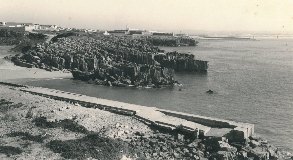 Vista sobre a praia do Porto da Areia Sul, Bairro do Visconde e Fortaleza de Peniche, década de 1970 / View over Porto da Areia Sul Beach, Visconde Quarter and Fortress of Peniche, 1970s
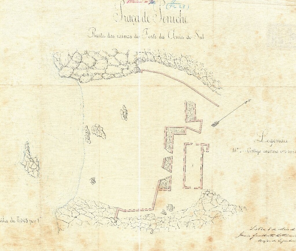
- Praça de Peniche: planta das ruínas do Forte da Areia do Sul, por Junio Gualberto Bettencourt Rodrigues, Major de Engenharia, 1885, PT-GEAEM/DIE-6296-4-58-69 [DIE 600] - Exército Português
Praça de Peniche, map of the ruins of Areia Sul Port, by Major Junio Gualberto Bettencourt Rodrigues, 1885, PT-GEAEM/DIE-6296-4-58-69 (DIE 600) - Portuguese Army
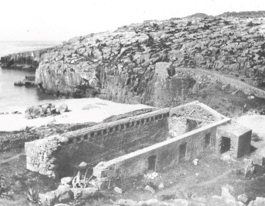
- Ruínas do Forte da Areia Sul, década de 1920, fotografia de Luís Correia Peixoto
Ruins of Areia Sul Fort, 1920s, photo by Luis Correia Peixoto
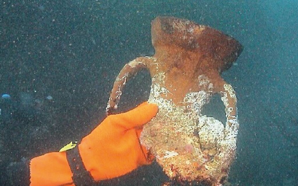
- Fragmento de ânfora tipo Haltern 70, utilizada para transporte de vinho, recolhida durante os trabalhos arqueológicos subaquáticos em 2004, fotografia de Carlos Henriques Antunes
Amphora fragment, Haltern 70 type, used for wine transportation, recovered during underwater archaeological works in 2004, photo by Carlos Henriques Antunes